|
|
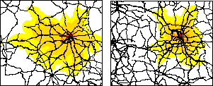
RRG GIS DatabaseInteraction data and regional data - IsochronesIsochrones represent the area that can be reached within a certain time from a selected point of interest by using a certain mode. Points of interest can be any point location such as cities, centroids of statistical entities such as NUTS regions or administrative regions, railway stations, inland ports or seaports, motorway intersections or motorway exits, airports, hospitals, universities, or any other set of point locations or network element. Modes can be cars and lorries, rail, inland shipping and sea shipping or any combination of these. For each selected point of interest, the travel time to each network element will be calculated. The isochrones then represent the area for which the travel time is shorter or equal to the given time threshold (e.g. one or two hours, or even ten hours). The isochrones will be provided as polygon layer. Isochrones can be generated for any time threshold required (for example, 45 minutes, 60 minutes, 90 minutes or any other value), and can also be calculated as nested polygons, i.g. isochrones for different time thresholds from the same origin.A detailed description of the methodology for constructing isochrones can be found here. An application of 45 minutes car travel times for some 1,600 Functional Urban Areas in Europe can be downloaded from the ESPON webpage (ESPON Project 1.1.1, Final Report Annex D).
RRG GIS Database contents:General informationTransport networks Region boundaries, admninistrative boundaries Geography Interaction data and regional data Introduction |
|||||||||
|
|||||||||