TRACECA: Transport Corridor Europe Caucasus Asia (2005 - 2006) |
|
| Partner: |
Dornier Consulting (Friedrichshafen) |
|

The TRACECA Programme was launched in 1993 to implement a programme of European Union (EU) funded technical assistance (TA) to develop a transport corridor on a west - east axis from Europe, across the Black Sea, through the Caucasus and the Caspian Sea to Central Asia, retaining the following objectives:
To support the political and economic independence of the republics by enhancing their capacity to access European and World markets through alternative transport routes
To encourage further regional co-operation among the partner states
To increasingly use TRACECA as a catalyst to attract the support of International Financial Institutions (IFIs) and private investors
To link the TRACECA route with the Trans - European Networks (TENs)
The TRACECA programme is financed by the European Commission, Directorate General External Relations, Europe and the Newly Independant States, Common Foreign and Security Policy, External Service Transcaucasis and Central Asia.
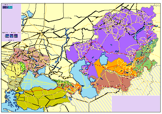
To date, the TRACECA space covers the countries of Armenia, Azerbaijan, Bulgaria, Georgia, Kazakhstan, Kyrgyzstan, Moldova, Romania, Tajikistan, Turkey, Ukraine, Uzbekistan, plus recently Iran, Turkmenistan and Afghanistan (TRACECA Member States).
The Permanent Secretariat of the IGC TRACECA commissioned RRG for the revision of the existing transport database, as well as for preparatory works for the introduction of a GIS. The overall objective of this activity was to develop a concept for the re-structuring of the present TRACECA database in order to satisfy two main criteria: (I) to pave the way for the introduction of a GI-system, and (II) to take into account the needs for future data collection from the TRACECA member states.
The overall project was subdivided into the following tasks:
- Development of a new database schema for the conversion of the existing non-spatial database into a GIS-format
- Conversion of the existing data into a format suitable for GI-systems
- Proposals for the selection of an appropriate GI-system
- Definition of steps necessary for the introduction of the GIS
The TRACECA database comprises the main transport arteries of the TRACECA Member States, regional boundaries, cities and point locations as well as socio-demographic and socio-economic base data.

|
|
|


