Home   |   Contact   |   Links   |   Imprint   |   Privacy   
[Deutsche Version]  
News
Competences
Projects
All projects
Publications
About us
TCP International

Projects

Accessibility Analysis of the Baltic Sea Region (2006)


Client:  BSR INTERREG III B Joint Secretariat (Rostock)
Partner:  S&W Urban and Regional Research (S&W) (Dortmund)

The objective of this study is to provide an up-to date picture of the accessibility situation of the BSR through a set of appropriate indicators. The study is organised along a number of different accessibility indicators which were partly based on the indicators developed in the transportoriented studies of the ESPON 2006 Programme. In this study, seven accessibility indicators will be elaborated for the BSR:

  • Car travel times to rail stations

  • Car and rail travel times to commercial airports

  • Lorry travel times to transport terminals

  • Car and rail travel times to large cities

  • Travel times between BSR cities

  • Multimodal potential accessibility to population and GDP

  • Mobile telephone penetration and internet access


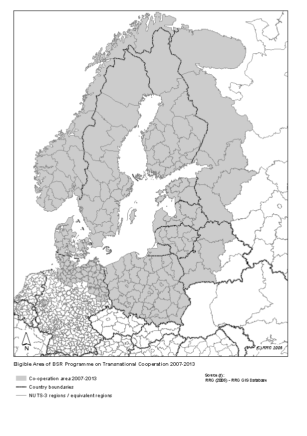
The analysis will be carried out for the territory of the BSR including the eligible areas in Russia and Belarus. In order to allow a straightforward interpretation of the indicators not only in the BSR context but also in the wider European context, the neighbouring territories will be included in the analysis.
RRG is responsible for the update and provision of the transport network database, for the calculation of a part of the indicators and for the generation of appropriate maps.


 More on this topic
Futher Information:  Project leader Klaus Spiekermann (S&W Stadt- u. Regionalplanung) or Carsten Schürmann for RRG.

Related documents:  2006.12.Accessibility_Analysis_of_the_Baltic_Sea_Region.zip

Links on the web:  Website Baltic Sea Region


Other projects in this field of competence:

Development of a system of indicators for monitoring the development of Sorbian/Wendish culture and language and their valorisation in Brandenburg (2022 - 2023)
Atlas of Industrialisation in the New Federal States (2nd edition) (2020 - 2021)
Development indicator system for "good life" for the Lusatia (2020)
INTERCONNECT Planning Tools for Public Transport (2019 - 2020)
Concept for a German-Danish spatial monitoring system (2017)
TeMoRi - Territorial Monitoring update and Regional Potential Index for the Baltic Sea Region (2016)
eMISK II - Improvements to Beatona portal (2015)
POIs for the Greater Bremen Region (2015)
Value-added in renewable energy sector (2014 - 2015)
ESPON UpTeMo (2014)
Serengeti Nationalpark (2014)
ESPON Matrices (2014)
Purchasing Power Analysis for a Shopping Centre Location in the City of Duisburg, Northrhine-Westfalia (2013)
Service Area Analysis for City Location in Langenfeld, Northrhine-Westfalia (2013)
SWOT Analysis of the South Baltic Cooperation Programme 2014-2020 (2013 - 2014)
Rail speeds: Update of Datasets for DG Regio (2013)
HTTransPlan - Impact Assessment of Railway Tunnel between Helsinki and Tallinn (2012 - 2013)
Atlas of Industrialisation in the New German Länder (2012 - 2013)
Accessibility Potential of German Regions (2012)
Cost matrices 1970-2010 for Europe (2012 - 2013)
SUTMP Windhoek (2012 - 2013)
Service area analaysis for the City of Münster (Northrhine-Westfalia) (2012)
ESPON BSR TeMo - Territorial Monitoring for the Baltic Sea Region (2012 - 2014)
Service area analaysis for shopping centre in Düren (Northrhine-Westfalia) (2011)
GeoCensus Kuwait (2011 - 2013)
LogMos II (2011 - 2014)
ITS Deployment Plan & HTMS Riyadh (2010 - 2011)
Speeds on railway sections according to actual timetablees (2010 - 2011)
Assessment of Central Places in Bavaria (2010)
Study on Mountain Areas in Southern Norway (2010)
ESPON INTERCO - Indicators of territorial cohesion (2010 - 2012)
ESPON TRACC: Transport Accessibility at Regional/Local Scale and Patterns in Europe (2010 - 2012)
Regional Challenges in the Perspective of 2020 (2010 - 2011)
Environmental Monitoring Information System Kuwait (eMISK) (2009 - 2012)
Status Report on the Establishment of the National Environmental Information Network Kuwait (NEIN) (2009)
TRACECA IDEA (2009 - 2012)
Western NIS (2009 - 2010)
AccBavaria (2008 - 2009)
Accessibility of Zillertal (2008)
East West Window Maps (2008)
Analysis of Nordic Labour Market Areas (2007)
Central Baltic Sea Region Maps (2007)
Regional Disparities and Cohesion (2007)
RePUS (2007)
ESPON Accessibility (2006 - 2007)
ESPON 4.1.3 (2006)
Volkswagen AutoMuseum: Isochrones Maps for the Cities of Wolfsburg and Leipzig (2006 - 2007)
FUNDING Infrastructure: Guidelines for Europe (2005 - 2007)
TRACECA: Transport Corridor Europe Caucasus Asia (2005 - 2006)
INTERREG III B (BSR) South Baltic Arc: Geodata Baltic Sea Region (2005)
Northern Peripheral, Sparsely Populated regions in the European Union (2005)
SETI (2005 - 2006)
AlpenCors (2004 - 2005)
FOPS 73.319: Regional Impacts of Transport Infrastructures (2004 - 2006)
Interaction data and regional data (2003)
RRG GIS Database (2003)
VietTrain: Toolbox for Railway Planning and Railway Management in Vietnam (2003 - 2004)
ESPON 1.1.1: The Role, Specific Situation and Potentials of Urban Areas as Nodes in a Polycentric Development (2002 - 2004)
ESPON 2.1.1: Territorial Impacts of EU Transport and TEN Policies (2002 - 2004)
Mountain Study - Analysis of mountain areas in Europe (2002 - 2004)
Via Egnatia: Motorway Case Study in Northern Greece (2002)
IASON: Spatial Impacts of European Transport Policies (2001 - 2004)
ILUMASS: Land Use and Transport (2001 - 2004)
National Atlas Germany (2000 - 2004)
Peripherality (2000)
Railway and road isochrones for Berlin and Hannover (1999 - 2000)
Supply Quality of the Retail Sector – A Modelling Approach (1999 - 2000)
Ufo Working Group: The New Main Railway Station of the City of Dortmund (1999)
Interfaces between GIS, Transport Models and other Simulation Models (1997 - 2004)
Quality of Life in European Regions (1996 - 2003)
Trans-European Transport Networks (1996 - 2004)

  © RRG, 2003-2023  ·  TOP