 |
 |
|
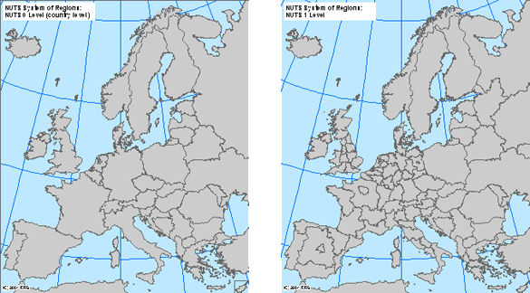
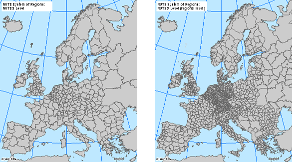
RRG GIS DatabaseRegion boundaries, admninistrative boundaries - Introduction to boundary layersAll region boundary and administrative boundary layers are based on the Nomenclature d'unitÚs territoriales statistiques (NUTS) of the Statistical Office of the European Union as defined by Eurostat in cooperation with the EU member states and candidate countries (Eurostat, 1995; 1999a; 1999b).The NUTS system of regions subdivides the area of the European Union (old and new member states) and the remaining candidate countries corresponding to national administrative or statistical areas into a hierarchical system of NUTS-0, NUTS-1, NUTS-2, NUTS-3, NUTS-4 and NUTS-5 regions, where the number indicates the level, with 0 being the member state or country level, and 5 being the municipality level. The member states are NUTS-0 regions. Each member state consists of several NUTS-1 regions, each NUTS-1 region consists of several NUTS-2 regions, etc. For instance, in Germany the NUTS-1 regions are the German 'Länder', the NUTS-2 regions are administrative districts and the NUTS-3 level represent counties and independent cities. In some cases NUTS-1 regions are also NUTS-2 region, and NUTS-2 regions are also NUTS-3 regions. Moreover, individual classified NUTS regions might be constituted of several polygons, for instance if several islands are encountered. Each NUTS level is available as an individual layer in the RRG GIS Database. However, the lower levels also contain attributive information on the higher NUTS levels (i.e. the NUTS 3 level layer also contains information on the aggregated NUTS 2 and NUTS 1 levels). This means, NUTS-2 or NUTS-1 or NUTS-0 regions can be aggregated from the NUTS-3 region layer. Hence it is ensured that lower and higher level boundaries correspond to each other.
Basically, two different types of layers are available: Layers that represent the boundaries of the regions in form of arcs and polygons, and layers that represent the centroids of the regions in form of points. The centroids of the regions do not necessarily represent the greatest city of the region (in terms of population), but they rather represent the political, administrative and cultural centre of the region. Apart from these region boundary and administrative boundary layers, there are additional ten polygon layers available representing the ten different INTERREG IIIB (2000-2006) cooperation areas, one layer per cooperation area. Each layer covers only those NUTS regions that constitute the specific cooperation area. The following cooperation areas are available: Northern Periphery, North Sea, Baltic Sea, North West Europe, Atlantic Area, CADSES, South West Europe, Western Mediterranean, as well as Alpine Space, and Archimed.
RRG GIS Database contents:General informationTransport networks Region boundaries, admninistrative boundaries Introduction to boundary layers Interaction data and regional data |
|||||||||
|
|||||||||


