 |
 |
|
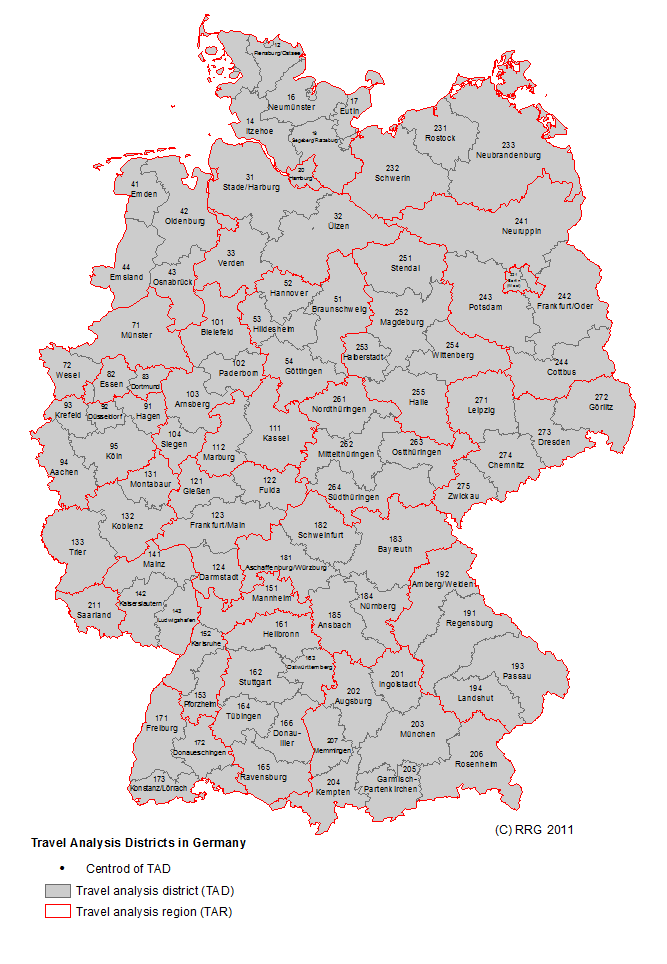
RRG GIS DatabaseTransport networks - Travel Analysis DistrictsGeneral information The travel analysis districts (or transport analysis districts; German: Verkehresbezirke) layer represents the travel analysis zones used for tranvel analyses and traffic forecasts at national (federal) level in Germany. Currently this layer is only available for Germany. The layer contains the polygon boundaries of these polygons, along with the district codes and the coordi-nates of the district centroids. The district codes can also be used to aggregate them to the next higher level, i.e. the so-called travel analysis regions (TARs; German: Verkehersgebiete). At the German federal level, there are currently 101 travel analysis districts (TADs), which can be aggregated to 27 travel analysis regions. The basic features of the TAD layer are as follows: Layer name: TAD Feature classes: Polygons No of polygon features: 130 User attributes associated with the polygons: 7 Detailed description of the polygon attribute table The TAD layer comprises seven user attributes, which are associated with each polygon (see following table):
ISO_OUNTRY_CODE indicates the 2-digits ISO code of the country in which the teavel analysis disteict is located. Because currently only Germany is covered in the layer, all polygons are marked as 'DE'. VB_CODE, VB_NAME, VBK_NAME and VB_CENTROID provide necessary information for each TAD. VB_CODE indicates the 3-digit code for each TAD. The code is generated in a hierarchical way, i.e. by aggregating the 3-digit codes with the first two digits one yield the code of the corresponding aggregated travel analysis region (TAR). VB_NAME provides the name of the TAD, while VB_CENTROID give the name of the centroid of each TAD. Usually the centroid name corresponds to the VB_NAME, but there are some exceptions from this rule. VBK_NAME then provides the name of the aggregated travel analysis region; this attribute may also be used by the DISSOLVE command to aggregate the TADs to the TARs. X-COORD and Y-COORD then provide the x-/y-coordinates of the TAD centroids. Usually this centroid location does not correspond to the mathematical / geographical centroid of the polygon, but it represents the main town within the district. In specific cases where one TAD consists of several polygons, each of these polygons will have the same x-/y-coordinates.
RRG GIS Database contents:General informationTransport networks Available transport datasets Geography Interaction data and regional data Informationen zur RRG GIS Datenbasis sind nur auf Englisch verfügbar. |
||||||||||||||||||||||||||||||||||||||||||||||||||||
|
||||||||||||||||||||||||||||||||||||||||||||||||||||

